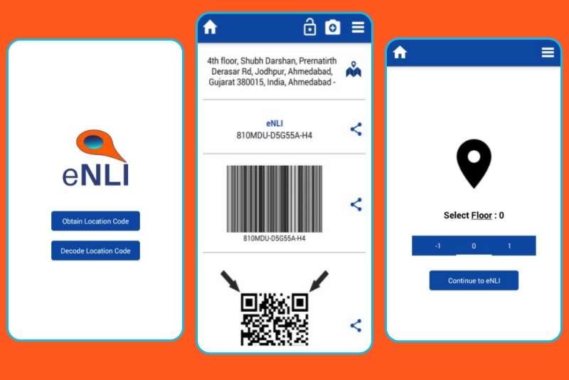
eNLI
Introduction :
The eNLI is an application which allows user to share location with floor of particular building / plant in encoded formate. By using this application, user can able to share his current location by selecting floor value by encoding in QR-Code formate via what’s app or any other social media platform. User can decode the location by scanning the QR code and can view it in google map as well.
Background :
- The mobile app is intended for the users of the specific company. The requirements were designed in way it can be use for industries where there are many plants and buildings. Through this app user can share his/her location with floor value so the other user can easily navigate to that particular location.

Evaluation of the case :
The mobile app is built in Android and iOS with Native development approach. It was a simple user friendly app with no user registration and authentication. It was having below functionalities:
Here, there are few challenges like:
- A startup Page
- Select floor value
- Encode location
- Share via multiple social media apps installed in mobile devices.
- Decode Barcode/QR-Code
- Show location on google map.
- Show floor value on pinpoint
- User manual for how to use the application
- Navigation drawer, to give options to redirect to other modules
Here, there are few challenges like:
- Getting the user’s current location, which requires location permission.
- Encoding user’s current location and floor value selected in barcode / QR code.
- Share this QR-code / Barcode via installed mobile apps.
- Decode barcode / QrCode and show on google map
- Google map integration
Proposed solution and changes :
We used MVC architecture to structured the project. Here we have used different third party libraries to achieve the functionalities. We need to maintain cross platform functionalities, like if the barcode / QR-code is generated via iOS devise, then it must decode with Android devices. We did proper testing with different devices to ensure the functionality. We integrated google maps SDK to show google maps and pinpoint of location over it. The click of pinpoint showed floor number which is been encoded in barcode / QR-code. We put all modules in side menu, so that user can quickly access any of the module. User manual was given so if user wants to understand any part of the app, then they can check that out from manual. Here the app requires two device permissions.
- 1) User’s current location
- 2) Camera to scan barcode / QR-code. By allowing them users can use all features of the app.
Conclusion :
It took almost 15-18 days to complete the project in both platforms with development and testing. We follow a process like analysis of requirements, understand the use case, prepare document, divide modules in small tasks, start development and unit testing, do integration testing and fix bugs, move to production. This help us move fast and achieve targets.